
PlanePlotter 可接收并解码 ACARS、ADS-B 和 HFDL 信号,实时显示飞机位置,支持 Google Earth 联动,是航空爱好者的必备工具。
原始标题:COAA PlanePlotter 6.7.7.2
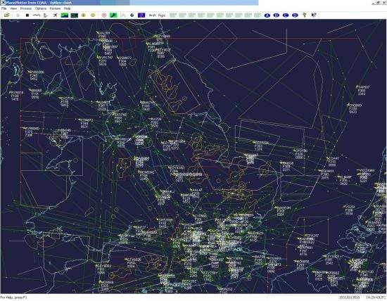
PlanePlotter 可以接收并解码来自飞机的实时数字位置报告,并将其绘制在图表上。使用 PlanePlotter,您可以看到周围所有正在传输适当数字消息(包括 ACARS、ADS-B 和 HFDL)的飞机的类似雷达的显示。
File Size: 6.5 MB
PlanePlotter receives and decodes live digital position reports from aircraft and plots them on a chart. Using PlanePlotter, you can see a radar-like display of all those aircraft around you that are transmitting the appropriate digital messages including ACARS, ADS-B and HFDL.
PlanePlotter – Features
The animated screen grab from PlanePlotter (left) was kindly provided by John Locker.
Message display
PlanePlotter shows a table display of messages received and decoded from live aircraft transmissions.
Data saving
PlanePlotter archives all the digital data that it receives and decodes to a log file.
Google Earth server
If you are receiving Mode-S ADS-B position reports, PlanePlotter can interface to Google Earth to display aircraft positions over the Google Earth base map. It can even give you a dynamic real-time view from the flight deck of an aircraft that you designate.
Direction finding
PlanePlotter can determine and display the direction of any transmission using a simple passive antenna switch. This allows aircraft to be located even if they are not equipped with ACARS or Mode-S/ADS-B.
此处内容需要权限查看
会员免费查看