本课程专为零基础学员设计,系统教授ArcGIS与遥感技术,涵盖空间数据管理、核心分析、地图排版及行业应用。通过14小时实操,掌握拓扑、缓冲区等关键技能,助力成为GIS分析师或技术专员。
原始标题:Master in ArcGIS, Remote Sensing & Spatial Analysis Course
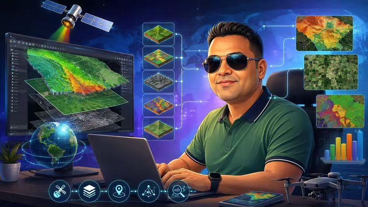
本课程是一门面向零基础的ArcGIS与遥感全功能实操指南,涵盖空间数据管理、核心空间分析、地图排版及行业实战,旨在帮助学员系统掌握GIS技能并对接专业岗位需求。该课程通过理论结合实际业务工作流,教授涵盖拓扑、缓冲区分析等在内的核心地理处理技术。更多课程信息,请参阅相关课程介绍。
Published 8/2026
MP4 | Video: h264, 1920×1080 | Audio: AAC, 44.1 KHz, 2 Ch
Language: English | Duration: 14h 16m | Size: 6.47 GB
From Beginner to GIS Professional: Master ArcGIS, Spatial Data Management, Geoprocessing, Mapping, and Remote Sensing.
What you’ll learn
Understand core GIS and Remote Sensing concepts, including spatial data models, coordinate systems, and geospatial data management.
Create, edit, and manage GIS datasets using ArcGIS, including geodatabases, feature classes, domains, subtypes, and topology.
Perform spatial analysis and geoprocessing operations such as Buffer, Intersect, Union, attribute queries, and location-based analysis.
Design professional GIS maps and layouts with symbology, labeling, legends, scale bars, and export-ready cartographic outputs.
Develop practical GIS skills that prepare them for GIS Analyst, GIS Technician, and Spatial Data Specialist roles
Understand GIS workflows used in government, utilities, urban planning, transportation, environmental, and infrastructure projects.
Requirements
No prior GIS or ArcGIS experience is required.
Basic computer skills and familiarity with using Windows applications.
Basic knowledge of Google Maps is helpful but not mandatory.
A willingness to learn geospatial technologies and spatial analysis concepts.
Access to a Windows computer on which ArcGIS Desktop can be installed for hands-on practice.
Description
Master in ArcGIS, Remote Sensing & Spatial Analysis is a comprehensive, hands-on course designed to help students, professionals, and aspiring GIS analysts build practical geospatial skills from the ground up. The course covers the fundamentals of Geographic Information Systems (GIS), Remote Sensing, spatial data management, and ArcGIS, one of the world’s leading GIS platforms.
You will learn how geographic data is collected, organized, managed, analyzed, and visualized for real-world applications. The course begins with core GIS and Remote Sensing concepts, including spatial data models, coordinate systems, map projections, and data sources. You will then gain hands-on experience with ArcGIS, exploring map creation, data editing, geodatabase development, digitization, georeferencing, and attribute management.
In addition, you will perform powerful spatial analyses using industry-standard geoprocessing tools such as Buffer, Intersect, Union, and Spatial Queries. The course also teaches professional cartography techniques, including map layouts, symbology, labeling, legends, scale bars, and map export. This Course is Industry Ready Course which provide you knowledge based on Industry requirements.
By the end of this course, you will be able to confidently create, manage, analyze, and present geographic data using ArcGIS. These skills are highly valuable for careers in GIS, urban planning, environmental management, utilities, transportation, infrastructure development, and geospatial technology.
Who this course is for
Students and graduates in Geography, Geology, Environmental Science, Civil Engineering, Urban Planning, Surveying, Agriculture, Forestry, and related fields.
Aspiring GIS Analysts, GIS Technicians, Mapping Specialists, and Spatial Data Professionals who want to build job-ready skills.
Government and private-sector professionals involved in land management, utilities, transportation, infrastructure, environmental monitoring, and planning projects.
Researchers and academicians who need GIS and spatial analysis tools for data visualization and decision-making.
Professionals looking to transition into the growing geospatial technology industry.
Anyone interested in learning how geographic data is collected, managed, analyzed, and presented using ArcGIS.
此处内容需要权限查看
会员免费查看