零基础起步,专注地球科学领域。本课程通过Jupyter Notebook带你掌握NumPy、Pandas等核心工具,构建岩性分类、储层参数预测等模型,提升学术与工业实战能力。
原始标题:Python and Machine Learning for Geoscience
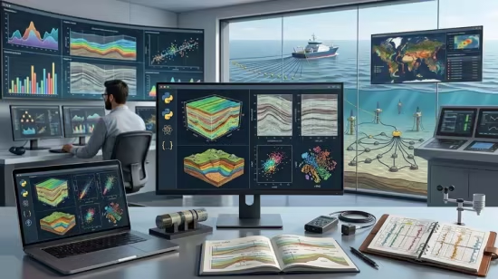
本课程是一门零基础起步、专注于地球科学领域的 Python 与人工智能实战指南。课程依托 Jupyter Notebook 交互式环境,带你全面掌握 NumPy、Pandas、Matplotlib、SciPy、Scikit-learn 以及 TensorFlow/Keras 等核心数据科学与深度学习工具。通过对真实世界地学数据集的清洗、可视化与建模,你将亲手构建起用于岩性自动分类、储层参数表征、环境监测、天气预测及矿产勘探的预测模型,最终具备将数据驱动技术独立应用于学术研究和地学工业界前沿问题的实战能力。
Published 7/2026
MP4 | Video: h264, 1920×1080 | Audio: AAC, 44.1 KHz, 2 Ch
Language: English | Duration: 14h 31m | Size: 7.44 GB
Master Python programming, data analysis, visualization, and machine learning techniques for solving real-world problems
What you’ll learn
Build a strong foundation in Python programming for geoscience applications.
Work with real-world datasets using Jupyter Notebook.
Develop predictive models for lithology classification, reservoir characterization, and environmental analysis.
Apply supervised and unsupervised machine learning algorithms to real geoscience datasets.
Complete practical projects that can be applied in academic research and industry.
Description
Artificial Intelligence (AI), Machine Learning (ML), and Python programming are transforming the way geoscientists analyze, interpret, and model Earth science data. From seismic interpretation and lithology classification to reservoir characterization, environmental monitoring, weather prediction, and mineral exploration, modern data-driven techniques have become essential tools for both research and industry. This course is designed to bridge the gap between geoscience and artificial intelligence by providing a practical, hands-on approach to Python programming and machine learning using real-world geoscience datasets.
The course begins with Python fundamentals and gradually progresses to data analysis, visualization, and machine learning. You will learn how to work with scientific libraries such asNumPy for numerical computing,Pandas for data manipulation,Matplotlib andSeaborn for data visualization,SciPy for scientific computing and statistical analysis, andScikit-learn for building machine learning models. You will also receive an introduction to deep learning with TensorFlow and Keras to solve more advanced geoscience problems.
Throughout the course, you will develop practical skills by implementing a wide range of machine learning algorithms. These includeLinear Regression,Multiple Linear Regression,Logistic Regression,Decision Trees,Random Forest,K-Nearest Neighbours (KNN),Support Vector Machines (SVM),Naïve Bayes,Gradient Boosting,XGBoost,AdaBoost,Principal Component Analysis (PCA),K-Means Clustering,Hierarchical Clustering,DBSCAN,Fuzzy C-Means,Apriori Association Rule Mining,Artificial Neural Networks (ANNs),Convolutional Neural Networks (CNNs),Long Short-Term Memory (LSTM) networks, and other modern deep learning techniques used in geoscience research.
Each topic is explained step-by-step, making the course suitable for beginners while also providing sufficient depth for researchers and professionals. By the end of the course, you will have the confidence to develop your own machine learning workflows, analyze complex geoscientific datasets, and apply artificial intelligence techniques to solve real-world Earth science problems.
Whether you are a student, researcher, educator, or industry professional, this course will equip you with the computational and analytical skills needed to harness the power of Python and machine learning in modern geoscience.
Who this course is for
Beginners who want to learn Python through geoscience examples
Industry professionals seeking AI skills
University lecturers and educators
Data scientists interested in geoscience
Geoscience, Earth Science learners
此处内容需要权限查看
会员免费查看